Safety: Avoid Busy Streets
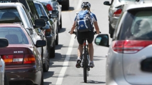
One of the biggest mistakes that people make when they start biking is to take the exact same routes they used when they were driving. It’s usually better to take different streets with fewer and slower cars. Sure, cyclists have a right to the road, but that’s a small consolation when you’re dead. ✎
The Portland Bureau of Transportation has an interactive map of Portland by Bicycle. I refer to this map whenever I’m creating a new route. It identifies neighborhood greenways, multi-use paths, which streets have bike lanes, and areas to avoid such as intersections that are difficult to navigate by bicycle – and more!
Another mapping option is to use Google Maps with the Bicycle layer enabled. This will help you map routes in Portland and around the world. Google can help you find routes to your desired destinations. It highlights bike paths, multi-use paths, and shared use routes. Google will even estimate how long the ride will take. As an example, for your trip to Amsterdam, you can map your bike route for lunch at McDonald’s from Nike.
Often, you can find local streets that are just a block away from and parallel to the busy road. Taking the nearby side streets can be just as fast and much more pleasant. Sometimes you can find routes that “cut the corner” of two major busy streets to save time and get to know a new neighborhood.
Consider how far you can take this strategy: If you learn your routes well, you’ll find you can travel through neighborhoods to get to most places, only crossing the busiest streets rather than traveling on them.
Gary Lunsford, Member at Large